

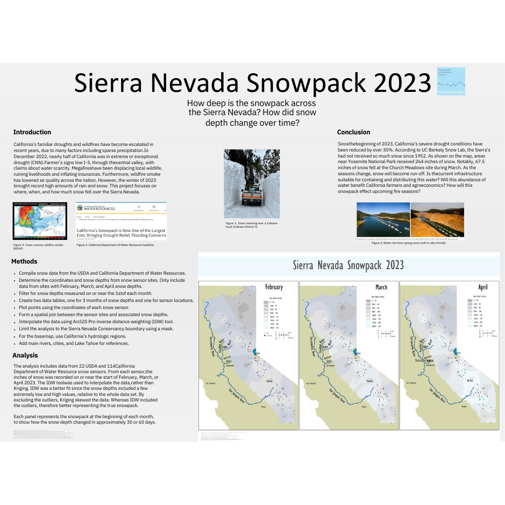
Sierra Nevada Snowpack
Objective: Final project for Applications of GIS: Environment and Natural Resources. Independently, analyze a spatial relationship through data acquisition and analysis.
Techniques: Spatial join, Inverse Distance Weighting tool, Convert labels to annotation, Masking, Custom fonts and colors
Data Sources: USDA and California Department of Water Resources
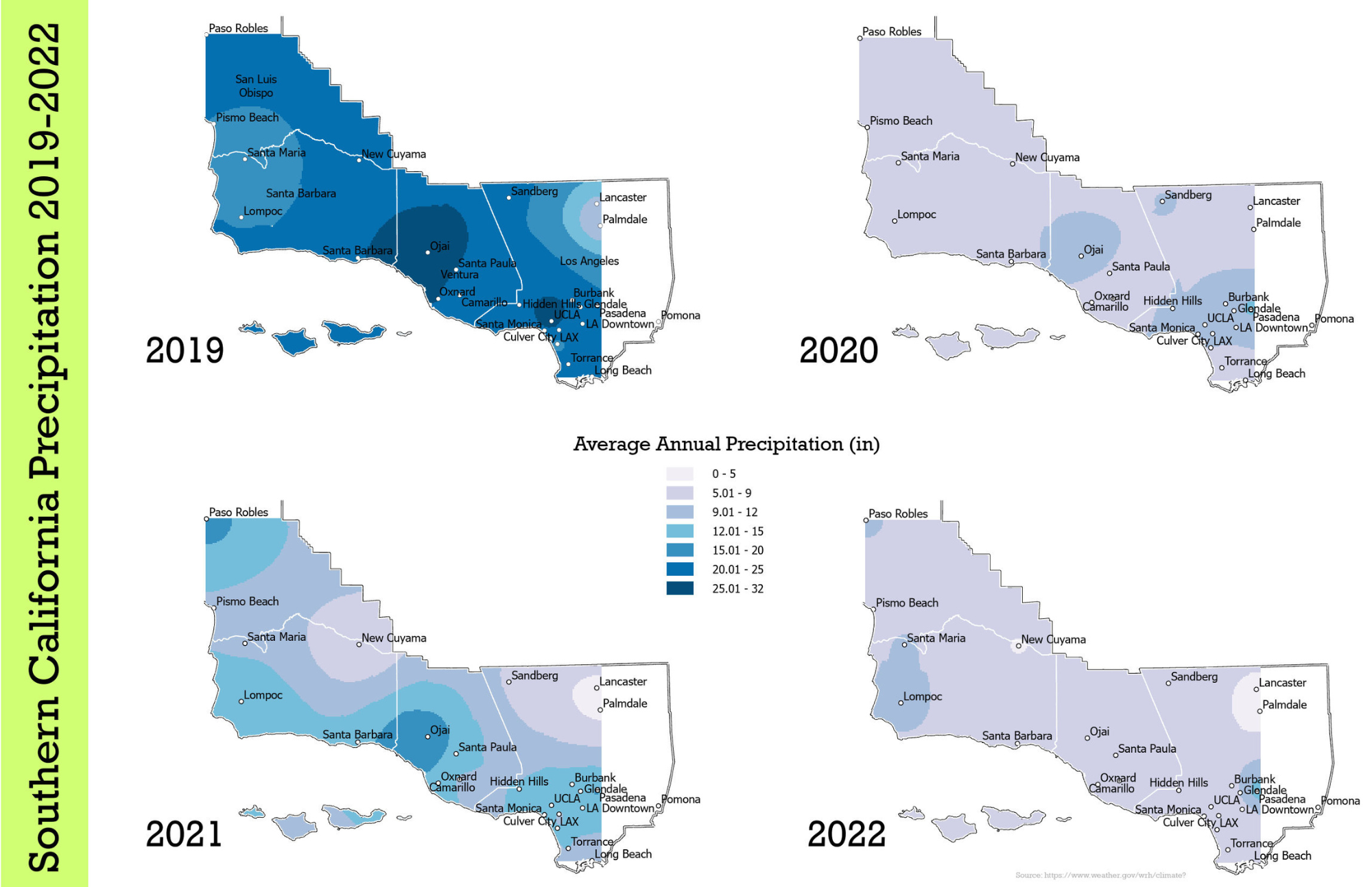
Southern California Precipitation 2019-2022
Objective: Represent the average annual rain fall in four consecutive years, across southern California. Standardize the measurements and associated colors across all four data sets, so that the resulting maps can be compared and contrasted.
Techniques: Data interpolation, Kriging, Reclassify, Spatial join
Data Sources: NOAA- NOWData
Program: ArcGIS Pro
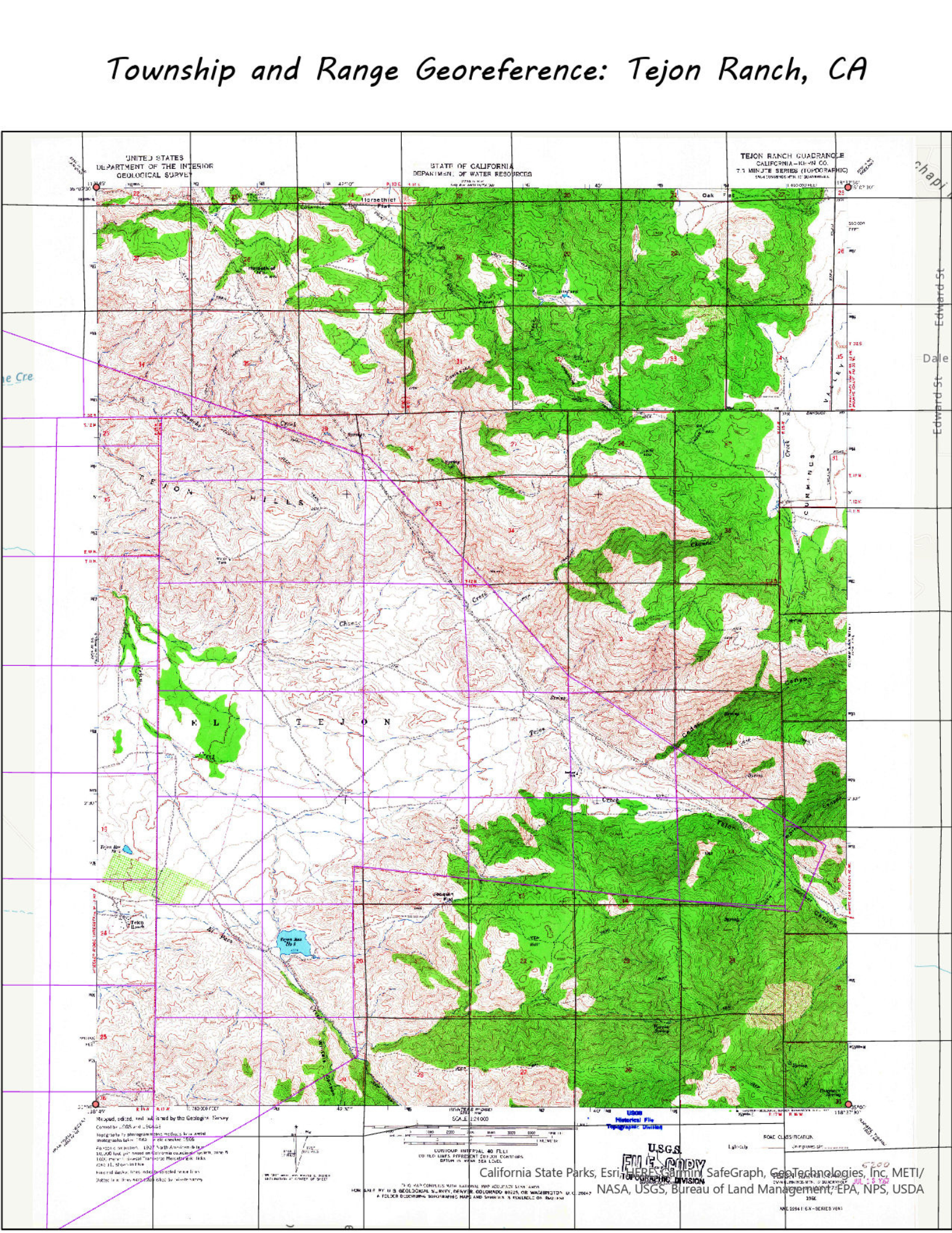
Township and Range Georeference: Tejon Ranch, CA
Objective: Understand the Public Land Survey System
Techniques: Control points, georeferencing
Data Sources: Instructor provided
Program: ArcGIS Pro
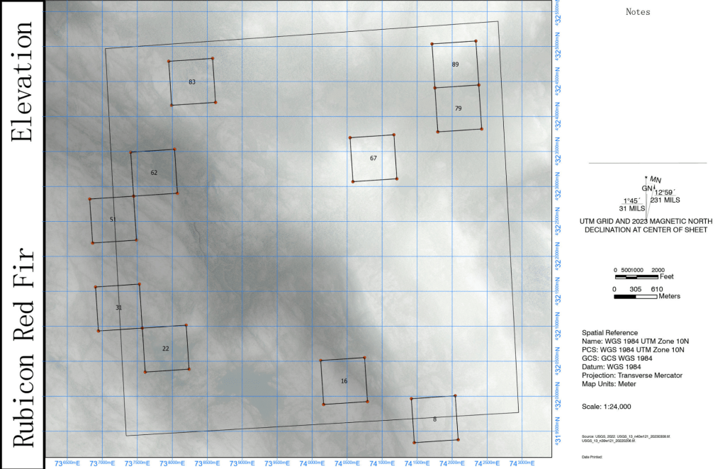
Rubicon Red Fir Elevation
Objective: Create a field map that is suitable for GPS use and focused on elevation.
Techniques: Transparency, PLSS, Dual north arrows, Snapping
Data Sources: Instructor provided
Program: ArcGIS Pro
Rubicon Red Fir Aerial
Objective: Create a field map that is suitable for GPS use and focused on aerial imagery.
Techniques: Transparency, PLSS, Dual north arrows, Snapping
Data Sources: Instructor provided
Program: ArcGIS Pro

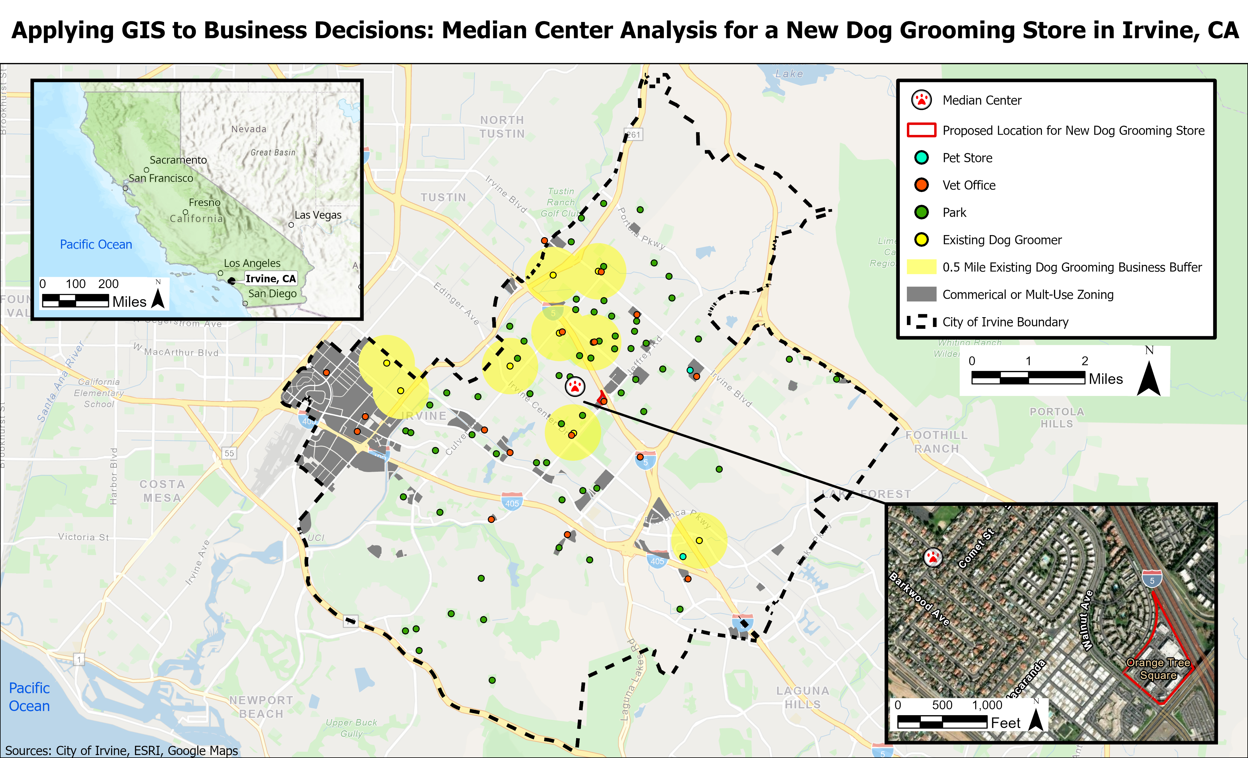
Applying GIS to Business Decisions: Median Center Analysis for a New Dog Grooming Store in Irvine, CA
Objective: Determine a location that a dog grooming business is likely to be successful within Irvine, CA. Close proximity to et stores, veterinarian offices and parks were considered advantageous, whereas existing dog groomers were considered disadvantages. Appropriate zoning was considered.
Techniques: Point pattern analysis, mean center analysis, georeferencing, buffer, erase, clip.
Data Sources: Google Maps,
Program: ArcGIS Pro

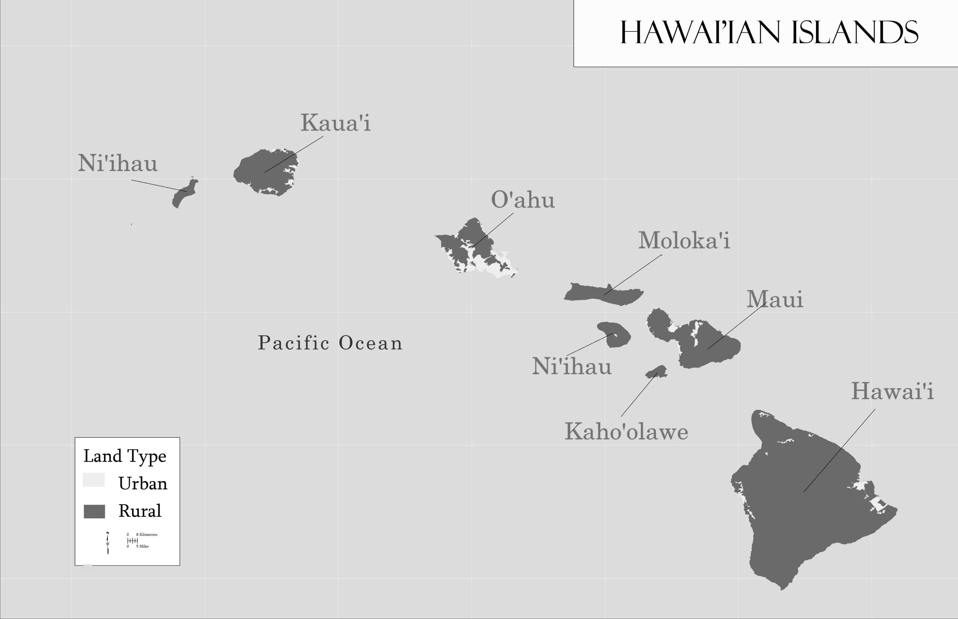
Hawai’ian Islands
Objective: Create a map in a style suitable for academic publication.
Techniques: Cartography, Grayscale color scheme, Diacritical marks, Convert labels to annotation
Data Sources: Instructor provided
Program: ArcGIS Pro

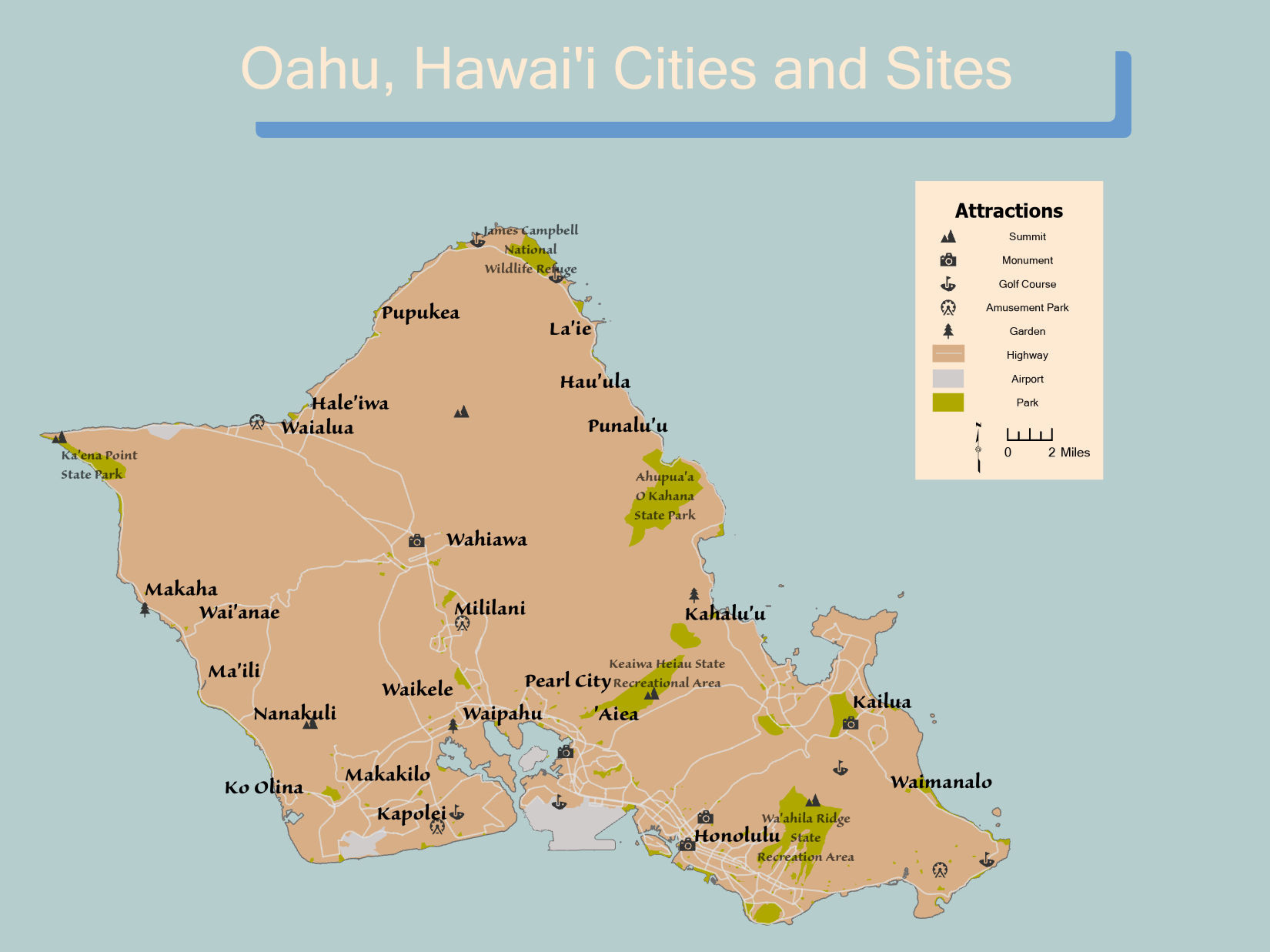
Oahu, Hawai’i Cities and Sites
Objective: Create a tourist map.
Techniques: Cartography, Custom colors, Diacritical marks, Convert labels to annotation, Symbology
Data Sources: Instructor provided
Program: ArcGIS Pro

